Creating Products and Knowledge for the Mediterranean
Since its launch back in June 2017 ODYSSEA, after completing a complex set of preparatory actions, has carried out a significant part of the project’s main tasks in the fields of systems development, data collection and forecast production. Over this 3-yearperiod, several achievements have been accomplished and delivered according to the initial work plan,something that will undoubtedly facilitate dealing with the challenges that still appear ahead of us.
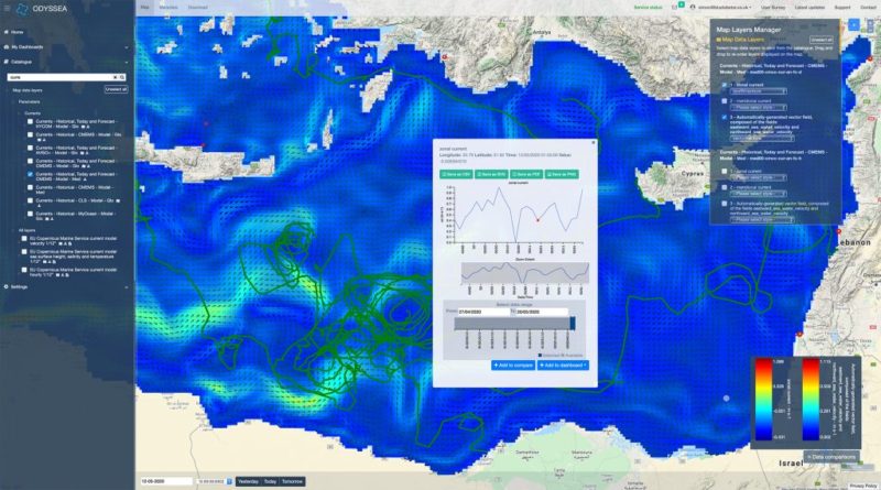
The Platform, the key deliverable of the project was upgraded and has advanced its operation, becoming more robust in its performance and capable to serve multiple users. The system is designed to be scalable and transferable to any cloud system(e.g., DIAS) by encompassing novel platform development tools. Several stakeholders and end-users across the Mediterranean have tested the Platform to obtain easy access to marine data and have provided their feedback through the online survey.
In parallel, significant progress is being made in the development and testing of the novel “chain”of operational numerical models,aiming to downscale the spatial and temporal resolution of existing Copernicus forecasting products.To couple efficiently these models and perform a series of automated tasks, like models initiation and ingestion of initial and boundary conditions, integration of on-site data, processing and assimilation in model results, and finally, forecasts transfer to the Platform, the Consortium has tested two different interfaces: the Delft-FEWS system and the Aquasafe environment. This experience led partners to conduct an in-depth comparative assessment of both systems according to a series of predefined criteria. I consider this as a noteworthy contribution of ODYSSEA to operational oceanography and a demonstration of its capacity to provide services.In terms of sensors, all have been developed according to the work plan. More specifically, the microplastic sensor was miniaturized and was integrated on the mobile and fixed monitoring systems built specifically for the project. The sensor revolutionizes our capacity to measure microplastic particles within the ocean water column.Glider tests were performed in the Gulf of Lions and results were found satisfactory. The main deployment with this sensor is scheduled to take place in Morocco this year. The surface and benthic fixed monitoring systems were developed and some of them already reached the relevant partners and are ready to be hosted by End-Users selected by Observatory managers.
In terms of services, the Consortium worked towards the development of algorithms and products to fulfill the needs of fish and mussel farmers,to alert on the outburst of jelly-fish blooms, to forecast and warn on eutrophication events, to understand the influence of environmental factors on the presence and distribution of sea grass species, to exploit the capacity of selected areas in marine renewable, to integrate environmental and fishery data and to link wind and wave storm data to shoreline change and coastal erosion dynamics.
Several challenges lie ahead and will need to be addressed until the end of the project in November2021. We have entered the phase of integration of all above described systems into the Platform. Users should be able to see a multi-modular tool capable of providing access to marine data from external providers,but also to produce highly accurate forecasts and digitized products at specific locations, the area of their activities at the sea. Furthermore,the Consortium seeks ways to ensure the sustainability of its operation, utilizing the operational oceanographic Platform as a tool for generating revenues. This is inline with the unanimous decision to gradually transform the Consortium into a corporate structure, achieving sustainability for the tools and systems developed within the project.For this purpose, the appropriate business strategy is being explored,aiming to identify opportunities in all marine and maritime sectors.

